Trusted shipping
Easy returns
Secure shopping
Buy GARMIN 2.6" GPS Navigation in United States - Cartnear.com
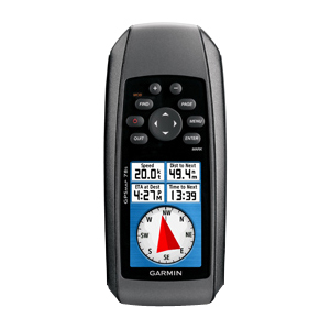
GARMIN 2.6" GPS Navigation
CTNR1207805 0753759100919 CTNR1207805Garmin
2027-02-23
/itm/garmin-26-gps-navigation-1207805
USD
213.21
$ 213 $ 220 3% Off
Item Added to Cart
customer
*Product availability is subject to suppliers inventory
SHIPPING ALL OVER UNITED STATES
100% MONEY BACK GUARANTEE
EASY 30 DAYSRETURNS & REFUNDS
24/7 CUSTOMER SUPPORT
TRUSTED AND SAFE WEBSITE
100% SECURE CHECKOUT
| Brand | GARMIN |
|---|---|
| Part Number | 010-00864-01 |
| Type | Handheld |
| Receiver | High-sensitivity receiver |
| Accuracy (Position) | < 10m, 95% typical |
| Accuracy With WAAS (Position) | 3 - 5m, 95% typical |
| Basemap | Yes |
| Waypoints | 2000 |
| POI | Custom POIs (ability to add additional points of interest) |
| Routes | Automatic routing (turn by turn routing on roads): with optional mapping for detailed roads |
| Memory | 1.7GB |
| Support Memory Cards | microSD |
| Screen Size | 2.6" |
| Screen Format | TFT |
| Display Resolution | 160 x 240 |
| Display Features | 65-K color |
| PC InterFace Supported | USB |
| Digital Player | Yes |
| Supported Formats | JPEG |
| Battery Type | 2 AA batteries (not included); NiMH or Lithium recommended |
| Battery Life | 20 hours |
| Min Operating Temperature | 5°F |
| Max Operating Temperature | 158°F |
| GPS System Features | Waterproof (IPX7) Floats Track log: 10,000 points, 200 saved tracks Electronic compass (tilt-compensated, 3-axis) Barometric altimeter Geocaching-friendly (paperless) Custom maps compatible Photo navigation (navigate to geotagged photos) Hunt/fish calendar Sun and moon information Tide tables Area calculation Unit-to-unit transfer (shares data wirelessly with similar units) Garmin Connect compatible (online community where you analyze, categorize and share data) |
| Color | Black |
| Height | 6.0" |
| Depth | 1.2" |
| Width | 2.6" |
| Weight | 7.7 oz. |
| Whats in the Box | GPSMAP 78s Wrist strap USB cable Quick start manual |
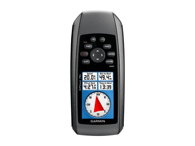
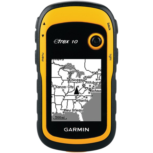
For boaters and watersports enthusiasts who want to run with the best, the rugged GPSMAP 78s features a 3-axis compass, barometric altimeter, crisp color mapping, high-sensitivity receiver, new molded rubber side grips, plus a microSD card slot for loading additional maps. And it floats!. GPSMAP 78s comes with built-in worldwide basemap, so you can navigate anywhere with ease. And, like the rest of the 78-series, 78s is IPX7 waterproof and even floats in water. GPSMAP 78s has a built-in 3-axis tilt-compensated electronic compass, which shows your heading even when you're standing still, without holding it level. Its barometric altimeter tracks changes in pressure to pinpoint your precise altitude, and you can even use it to plot barometric pressure over time, which can help you keep an eye on changing weather conditionsBuilt-in Devices: AltimeterBuilt-in Devices: CompassFeatures: Area CalculationFeatures: Tide TableFeatures: Custom POIFeatures: Hunt/Fish CalendarFeatures: Water ProofFeatures: High-sensitivity ReceiverMemory Card Supported: microSD CardScreen Size: 2.6Color Supported: 262144 Colors (18-bit)USB: YesMaximum Battery Run Time: 20 HourForm Factor: PortableHeight: 6"Width: 2.6"Depth: 1.2"Weight (Approximate): 7.70 ozPackage Contents: GPSMAP 78s Marine NavigatorWrist StrapUSB CableQuick Start ManualPackage ContentsGPSMAP 78s Marine NavigatorWrist StrapUSB CableQuick Start Manual"

